Thamel Gahiti, Kathmandu, Nepal
Earth Matter Treks & Expedition Nepal
  • Destination

    Nepal

  • Regions

    Dhaulagiri

  • Activity

    Trekking

  • Accomodation

    Hotel/Lodge

  • Transportation

    Flight/Drive

  • Duration

    16 Days

  • Trip Grade

    Strenous

  • Altitude

    French Pass: 5,360 meters (17,585 feet and Beni: 830 meters (2,723 feet)

  • Best Season

    Spring (March to May) and Autumn (September to November)

  • Start/End Point

    Beni-Jomsom

Destination Region Activity Accomodation Transportation
Nepal Dhaulagiri Trekking Hotel/Lodge Flight/Drive
Duration Trip Grade Altitude Best Season Start/End Point
16 Days Strenous French Pass: 5,360 meters (17,585 feet and Beni: 830 meters (2,723 feet) Spring (March to May) and Autumn (September to November) Beni-Jomsom

Trip Overview

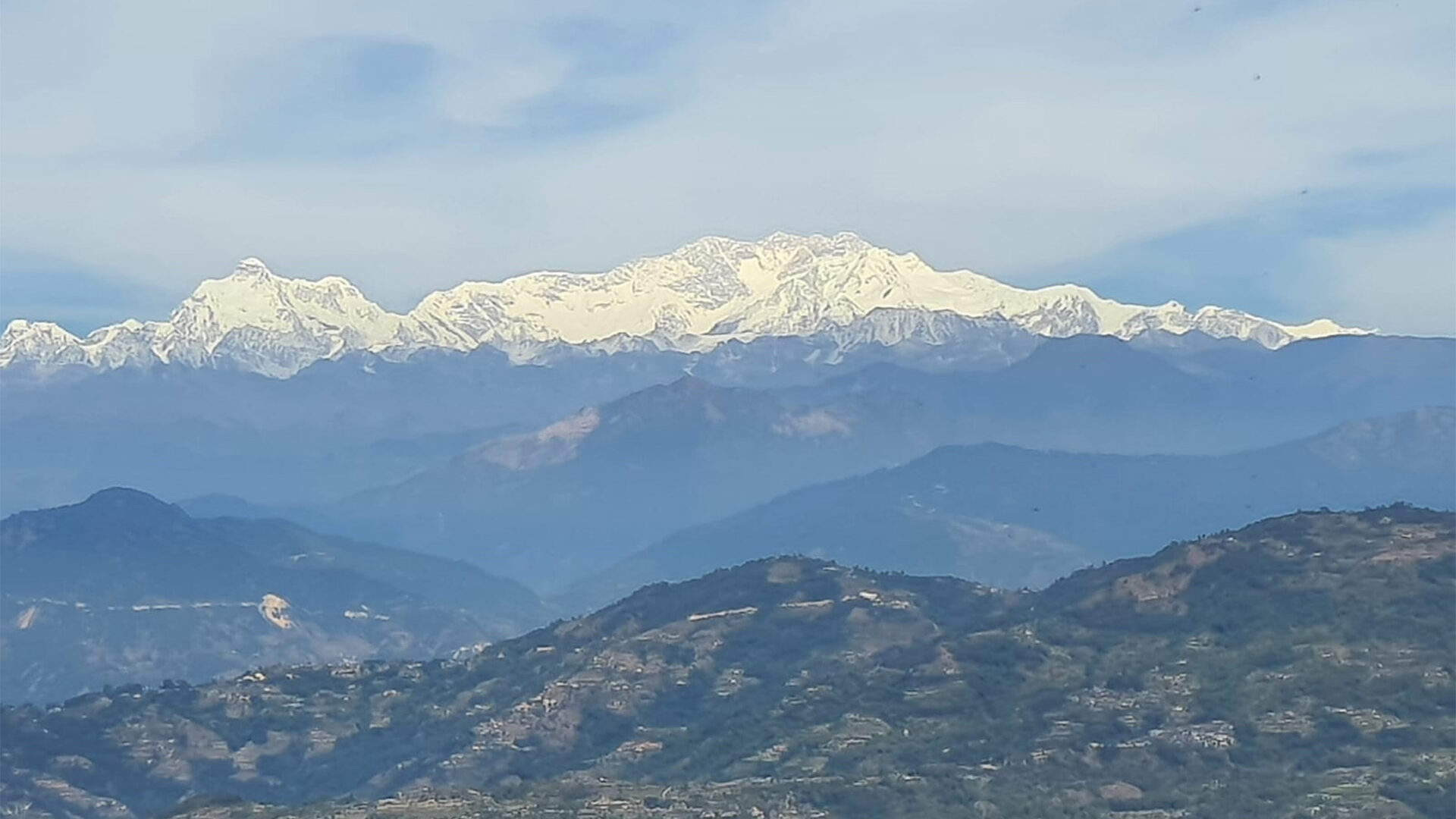
The Dhaulagiri Base Camp Trek is a thrilling journey that takes you to the base of the seventh-highest mountain in the world, Dhaulagiri I. This trek is known for its rugged terrain, high altitude, and stunning scenery. The Dhaulagiri Base Camp Trek is a challenging and rewarding adventure in the Dhaulagiri region of Nepal, known for its remote and rugged terrain.

Trip Highlights

  • Dhaulagiri I Base Camp: Located at 4,750 meters (15,580 feet), offering breathtaking views of the Dhaulagiri massif.
  • Remote and Less Crowded: Unlike some other popular treks in Nepal, this route sees fewer trekkers, providing a more solitary experience.
  • Diverse Landscapes: From terraced fields and forests to glaciers and high mountain passes.
  • French Pass and Dhampus Pass: Two challenging high passes that offer panoramic views of the surrounding peaks.

Itinerary

  • Altitude: 830 meters (2,723 feet)
  • Duration: 8-9 hours
  • Description: A scenic drive through Nepal's countryside, passing through small towns and villages.

  • Altitude: 950 meters (3,117 feet)
  • Duration: 5-6 hours
  • Description: The trek begins with a gentle ascent, passing through terraced fields and small settlements.

  • Altitude: 1,560 meters (5,118 feet)
  • Duration: 6-7 hours
  • Description: The trail follows the Myagdi Khola River, passing through lush forests and traditional villages.

  • Altitude: 1,850 meters (6,070 feet)
  • Duration: 6-7 hours
  • Description: A mix of ascents and descents through terraced fields and dense forests.

  • Altitude: 2,080 meters (6,824 feet)
  • Duration: 7-8 hours
  • Description: The trail becomes steeper, with more challenging ascents and descents.

  • Altitude: 2,520 meters (8,267 feet)
  • Duration: 6-7 hours
  • Description: A challenging day with steep climbs and descents through dense forests.

  • Altitude: 3,660 meters (12,008 feet)
  • Duration: 6-7 hours
  • Description: The trail continues to ascend, offering stunning views of the Dhaulagiri massif.

  • Altitude: 3,660 meters (12,008 feet)
  • Description: A rest day to acclimatize to the high altitude. Short hikes around the camp are recommended.

  • Altitude: 4,200 meters (13,779 feet)
  • Duration: 5-6 hours
  • Description: A challenging day as the trail moves onto the glacier, requiring careful navigation.

  • Altitude: 4,750 meters (15,580 feet)Altitude: 4,750 meters (15,580 feet)
  • Duration: 5-6 hours
  • Description: The trail continues on the glacier, leading to the base camp with spectacular views of Dhaulagiri I.

  • Altitude: 4,750 meters (15,580 feet)
  • Description: A rest day to acclimatize. Enjoy the breathtaking views and explore the surrounding area.

  • Altitude: 5,360 meters (17,585 feet) at French Pass, 5,200 meters (17,060 feet) at Hidden Valley
  • Duration: 6-7 hours
  • Description: A strenuous day crossing the French Pass, offering panoramic views of the surrounding peaks.

  • Altitude: 5,240 meters (17,192 feet) at Dhampus Pass, 3,680 meters (12,073 feet) at Yak Kharka
  • Duration: 6-7 hours
  • Description: Another challenging day crossing the Dhampus Pass and descending to Yak Kharka.

  • Altitude: 2,720 meters (8,923 feet)
  • Duration: 5-6 hours
  • Description: A gradual descent to Jomsom, passing through beautiful landscapes and small villages.

  • Altitude: 820 meters (2,690 feet)
  • Duration: 20-minute flight
  • Description: A short, scenic flight back to Pokhara.

  • Altitude: 1,400 meters (4,593 feet)
  • Duration: 6-7 hours by drive or 30-minute flight
  • Description: Return to Kathmandu, concluding the trek.

Cost Inclusion/Exclusion

Cost Inclusion

  • Airport pick-up and drop-off in Kathmandu.
  • Ground transportation from Kathmandu to Beni and return from Pokhara to Kathmandu.
  • Domestic flight from Jomsom to Pokhara.
  • Hotel accommodation in Kathmandu and Pokhara (usually on a bed and breakfast basis).
  • Teahouse accommodation during the trek where available.
  • Camping equipment including tents and sleeping mats for higher altitude camps.
  • Full board meals (breakfast, lunch, and dinner) during the trek.
  • Annapurna Conservation Area Permit (ACAP) and TIMS (Trekkers' Information Management System) card.
  • Guide and porter insurance, salary, food, and accommodation.
  • Camping equipment including tents, dining tent, kitchen tent, and toilet tent.

Cost Exclusion

  • Flights to and from Kathmandu.
  • Comprehensive travel insurance covering emergency evacuation, medical treatment, and trip cancellation.
  • Personal trekking equipment (clothing, boots, sleeping bag, etc.).
  • Drinks (alcoholic and non-alcoholic beverages) and snacks.
  • Internet, phone calls, and other communication costs.
  • Extra nights in Kathmandu and Pokhara due to early arrival, late departure, or early return from the trek (due to any reason).
  • Any other services not specified in the inclusions.